
How to Test Your Boat's Real Speed with GPS
A disagreement alone does not identify which instrument is wrong. Compare their different reference frames and measurement conditions before changing calibration.
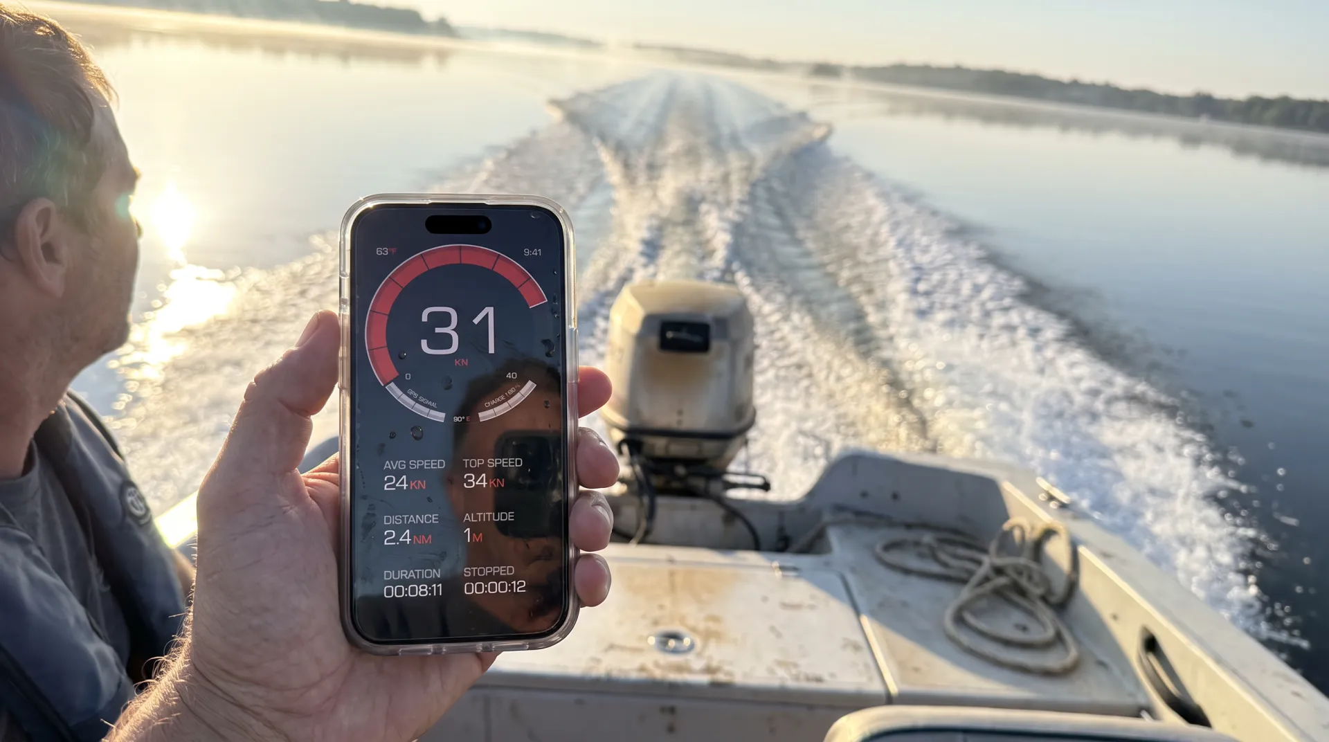
Table of Contents
Introduction
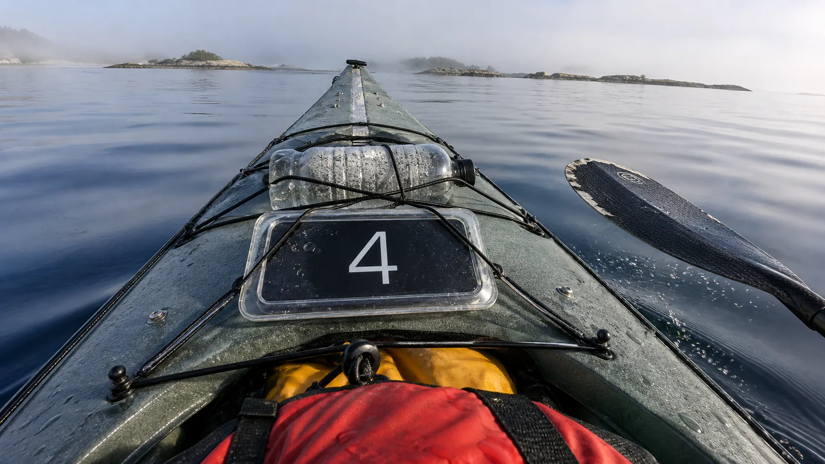
Illustrated method, not a field-test report. The numbers below are hypothetical. The boat scenes, including the lead image and kayak, are AI-generated composites; the diagrams explain a model. None is evidence of an actual app test.
Your knotmeter says 6.2 kn (7.1 mph)6.2 kn (11.5 km/h). The phone clipped to the helm says 7.4 kn (8.5 mph)7.4 kn (13.7 km/h). Same boat, same second, two numbers more than a knot apart. Which one is lying?
A disagreement alone does not identify which instrument is wrong. Compare their different reference frames and measurement conditions before changing calibration.
Two opposite runs do not automatically remove the current’s effect. Use the assumptions in the method below before interpreting their average.
Key Takeaways
- The app shows GPS speed over ground (SOG), including knots. It does not measure speed through water (STW) or calculate velocity made good (VMG). Currents can change the difference between SOG and STW.
- GPS provides an estimate of speed over ground, independent of wheel size. Signal quality, obstructions, low speed and processing can affect the reading. A fixed percentage error or greater accuracy than another instrument is not guaranteed.
- Recording, saving and basic viewing of trips are free. Detailed route playback and analysis require PRO.
- The app records SOG. A two-run STW estimate is a separate manual calculation with strict conditions.
- 1 knot = 1 nautical mile per hour = 1.852 km/h exactly (approximately 1.15078 mph). One international nautical mile is exactly 1,852 metres.
Why Your Boat’s Own Instruments Drift
A paddle-wheel log infers speed through water from rotation. Fouling, wear and calibration can affect its reading. GPS provides a separate estimate over ground; independence from the paddle wheel does not guarantee greater accuracy.
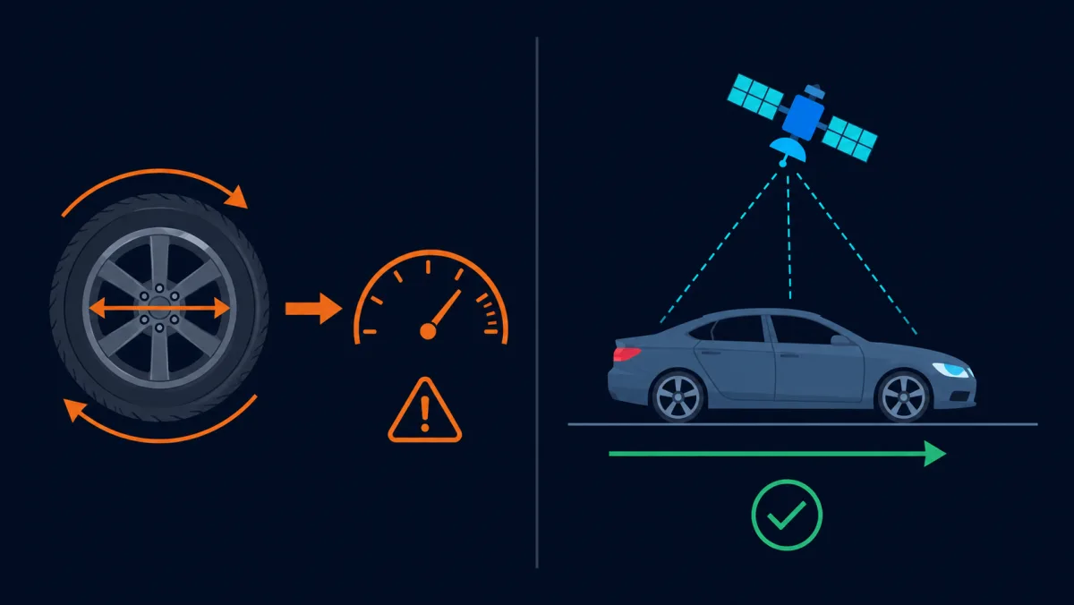
GPS provides an estimate of speed over ground, independent of wheel size. Signal quality, obstructions, low speed and processing can affect the reading. A fixed percentage error or greater accuracy than another instrument is not guaranteed.
Speed Through Water vs Speed Over Ground
There are two legitimate answers to “how fast is this boat going”, and they are different quantities.
Speed through the water (STW) is your speed relative to the water you are floating in — what a paddle wheel or pitot tube measures, and the number that matters for sail trim and hull performance. Speed over the ground (SOG) is your speed relative to the seabed — what GPS measures, and the number that matters for passage planning, your ETA, and whether you will clear that headland before the tide turns.
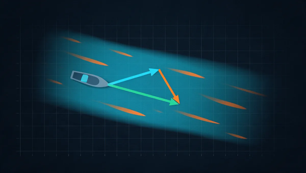
Go back to the pair of numbers from the introduction. The knotmeter reads 6.2 kn (7.1 mph)6.2 kn (11.5 km/h) and GPS reads 7.4 kn (8.5 mph)7.4 kn (13.7 km/h). On a straight course with the current directly behind you, that gap of 1.2 kn (1.4 mph)1.2 kn (2.2 km/h) is the tide pushing you along — plus whatever your knotmeter is getting wrong. One reading cannot separate the two. Turn around and run the reciprocal course, and the same tide now subtracts: the knotmeter still reads about 6.2, but GPS drops to roughly 5.6 kn (6.4 mph)5.6 kn (10.4 km/h).
What a GPS Speed Test Actually Measures
The app shows GPS speed over ground (SOG), including knots. It does not measure speed through water (STW) or calculate velocity made good (VMG). Currents can change the difference between SOG and STW.
GPS provides an estimate of speed over ground, independent of wheel size. Signal quality, obstructions, low speed and processing can affect the reading. A fixed percentage error or greater accuracy than another instrument is not guaranteed.
GPS.gov distinguishes satellite signal performance from the accuracy of a particular receiver. Its signal specifications are not a measured speed-error bound for this app, and positional accuracy in metres is not speed accuracy in mph or knots. GPS.gov — GPS accuracy.
Two Reciprocal Runs: A Conditional Estimate
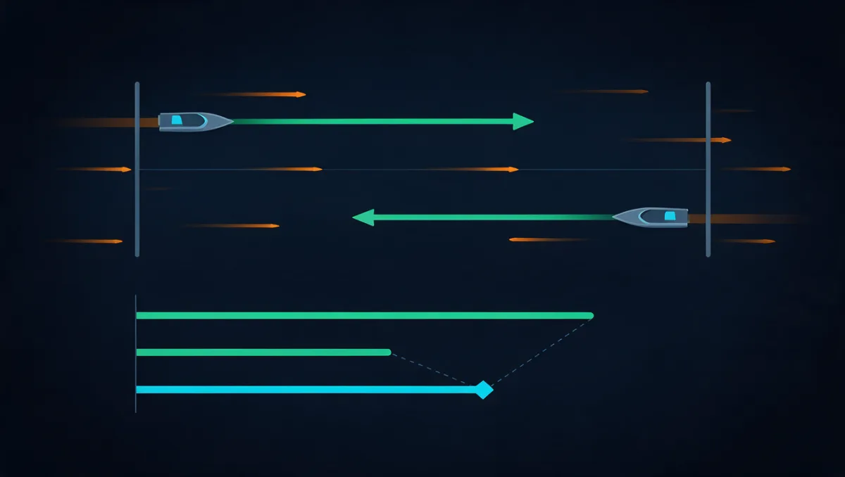
This is a manual calculation, not a native STW or VMG feature. Averaging two reciprocal runs estimates speed through water only if the current is constant and parallel to the course, the boat holds the same speed through water on both runs, and measurement errors are small. The worked numbers are illustrative, not a recorded app test. The boat must also make progress against the current: its speed through water must exceed the current speed.
How to run it
Choose a clear, suitable stretch of water. Keep load, trim and throttle setting consistent; allow speed to settle without assuming a fixed waiting time. Record a defined pass, then a reciprocal pass under comparable conditions. Use each pass’s average SOG for the manual example below.
The arithmetic
Under those assumptions, these illustrative averages give the following manual estimates:
STW estimate = (7.4 + 5.6) / 2 = 6.5 kn
current estimate = (7.4 - 5.6) / 2 = 0.9 kn
These estimates follow the model’s assumptions. They are not current or STW measurements made by the app.
Changing current, a cross-current, wind, waves or unequal boat speed can invalidate the estimate. A cross-current must be treated as a vector: holding a heading and holding a ground track are different cases. Repeating the passes can reveal inconsistency but does not guarantee removal of those effects. Without the stated assumptions, retain the measured SOG rather than label the average as STW.
What to Record
A maximum is the highest recorded sample and can reflect a transient or measurement error. A defined pass average is more useful for comparing sustained performance, but still depends on valid readings and consistent recording boundaries.
Write down the conditions alongside the numbers: throttle setting or engine RPM, trim and tab position, fuel and water aboard, number of people, sea state, and wind direction relative to the course. A boat that made 6.5 kn (7.5 mph)6.5 kn (12.0 km/h) light and flat will not repeat it with full tanks and four guests, and if you did not note the difference you will spend the winter wondering what went wrong with the engine.
Recording, saving and basic viewing of trips are free. Detailed route playback and analysis require PRO.
PRO unlocks route playback, speed and altitude charts, and detailed trip analysis. Trips saved while PRO stay unlocked if PRO later expires.
GPX export and trip sharing also require PRO.
Why Boat Speed Is Measured in Knots
One knot is one nautical mile per hour. The international nautical mile is exactly 1,852 metres, so 1 kn equals 1.852 km/h. These are unit conversions, not app accuracy claims. NOAA — Nautical miles and knots.
For a different value, use the knots to mph converter to convert knots, miles per hour and kilometres per hour without location permission.
The conversions, for when you need to talk to someone on land:
| Speed | Equivalent |
|---|---|
| 1 knot | 1.15078 mph1.852 km/h |
| 5 knots | 5.75 mph9.26 km/h |
| 10 knots | 11.51 mph18.52 km/h |
| 20 knots | 23.02 mph37.04 km/h |
| 30 knots | 34.52 mph55.56 km/h |
Before Changing Your Knotmeter Calibration
Use a manufacturer-approved calibration procedure. A conditional two-way estimate can inform a comparison, but it is not a certified reference. In the illustrative example, an estimated 6.5 kn against a 6.2 kn instrument reading gives this correction ratio:
ratio = 6.5 / 6.2 = 1.048
(6.5 / 6.2 - 1) × 100 = 4.8%
Raymarine’s procedure calls for minimal or no tide/current. Follow your own instrument’s instructions.
If readings remain inconsistent after appropriate cleaning and checks, consult the instrument manufacturer or a qualified technician before changing calibration further.
Frequently Asked Questions
How do I check my boat speed in knots right now?
The app shows GPS speed over ground (SOG), including knots. It does not measure speed through water (STW) or calculate velocity made good (VMG). Currents can change the difference between SOG and STW.
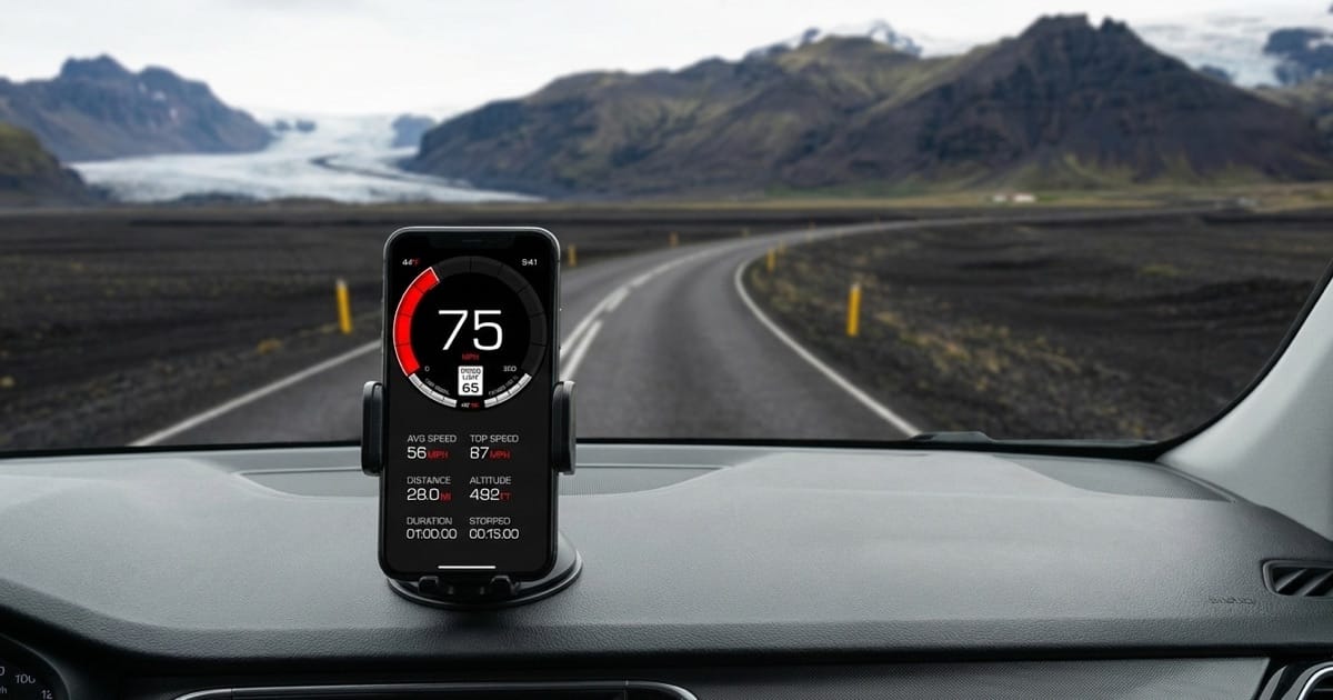
In the iPhone app, select knots and allow location access. For a one-off reading without an installation, open the online speedometer in a compatible phone browser, select knots, tap Start and allow the browser to use your location. Both report speed over ground; the browser tool is separate from the app’s saved-trip features.
Allow time for a usable location reading and keep a clear view of the sky. Acquisition time varies with the device and surroundings; there is no fixed waiting time.
Why does my knotmeter disagree with my phone’s GPS?
Ground velocity equals velocity through the water plus the current vector. Subtracting the two scalar speed readings gives a current estimate only in a suitable collinear case; instrument error can also explain part of the difference. A disagreement alone does not identify which instrument is wrong. Compare their different reference frames and measurement conditions before changing calibration.
How accurate is a GPS boat speed test?
GPS provides an estimate of speed over ground, independent of wheel size. Signal quality, obstructions, low speed and processing can affect the reading. A fixed percentage error or greater accuracy than another instrument is not guaranteed.
How long should a boat speed test course be, and how many passes?
Choose a clear, suitable stretch of water. Keep load, trim and throttle setting consistent; allow speed to settle without assuming a fixed waiting time. Record a defined pass, then a reciprocal pass under comparable conditions. Use each pass’s average SOG for the manual example below.
Use reciprocal courses with constant, parallel current and the same through-water speed on both passes. The boat must make progress against the current, and measurement errors must be small. Cross-current, changing conditions or unequal speed can invalidate the average as an STW estimate.
Do wind and current affect the GPS speed reading?
Changing current, a cross-current, wind, waves or unequal boat speed can invalidate the estimate. A cross-current must be treated as a vector: holding a heading and holding a ground track are different cases. Repeating the passes can reveal inconsistency but does not guarantee removal of those effects. Without the stated assumptions, retain the measured SOG rather than label the average as STW.
Sources & further reading
- Raymarine — navigation glossary: SOG, STW and COG
- GPS.gov — GPS accuracy
- NOAA — Nautical miles and knots
Conclusion
Use GPS for speed over ground. Treat the manual two-run result as a conditional estimate, not as measured STW, current, VMG or a certified calibration reference.
For iPhone trip recording, select knots and use the GPS boat speedometer guide to check the free and PRO features. The app measures SOG only. For the measurement limits behind the display, read how GPS speedometers work.
Core GPS speed tracking and trip recording work without internet, with location permission and a usable GPS signal. Automatic road-speed-limit data and weather need internet. Maps and other connected features may be unavailable offline.
Free to download, with no ads. PRO is available through a subscription or a one-time purchase; both unlock the same PRO features. The price depends on your region and current offer; check Apple’s purchase screen.