
Best Speed Camera Detector Apps for iPhone (2026)
Compare five iPhone camera-alert apps by task, data source and limitations. GPS warnings, offline data and regional rules explained without a tested ranking.
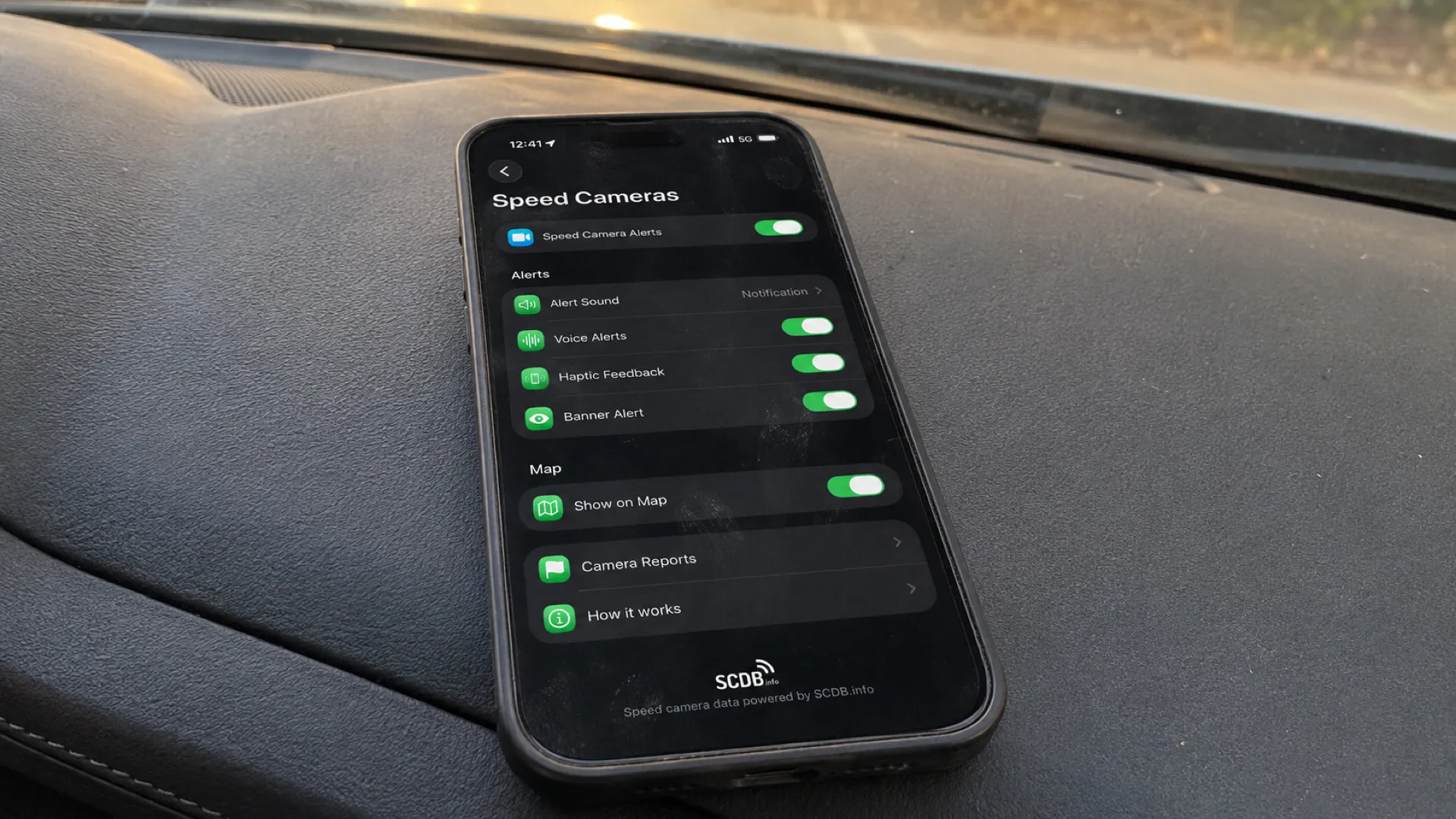
Table of Contents
September 10, 2026: we narrowed product, data-source and legal wording. Our product and dated ratings were corrected on September 9. Competitor observations retain their original source dates; this is not a new competitor test. The numbered sections are a reading order, not a performance ranking.
Quick answer
An iPhone on its own does not receive police K/Ka/X-band radar signals. These apps use GPS with known camera locations or reports; they do not directly detect a radar gun. Choose by task: Radarbot for a dedicated camera-alert app, Waze for navigation with community reports, or GPS Speedometer MPH Tracker for a GPS speedometer and trip tools with PRO camera alerts. Our SCDB.info camera data covers 40+ supported countries, subject to available records and regional behavior.
Free to download, with no ads. PRO is available through a subscription or a one-time purchase; both unlock the same PRO features. The price depends on your region and current offer; check Apple’s purchase screen.
Keep the distinction between a GPS location warning and a hardware detector in mind when reading any app listing. Neither a stored location nor a recent report guarantees that every camera is covered.
What iPhone speed-camera apps can and can’t do
Can’t: directly detect police radar transmissions with the iPhone’s own hardware. Radar detection needs a suitable radio receiver; lidar detection uses dedicated optical equipment. A GPS camera alert is neither of those.
Can: compare your GPS position with a known, mapped camera or enforcement zone and warn on approach, where the app and local rules permit it. Location databases and reports serve different purposes:
- Location databases (like SCDB.info) — store known camera sites and zones. Their records and supported categories depend on the provider, the app and the region. Provider maintenance can use checks and user reports.
- Community reports (like Waze) — can describe recent police activity and hazards. Their availability and usefulness depend on submissions, timing and local conditions; they are not a complete live inventory.
A saved site may be useful even if enforcement there is occasional, but it does not establish whether a mobile unit is present now. Reports can also be missing or out of date. Treat these tools as information about known or reported locations, not a guarantee of complete coverage.
Comparison at a glance
| App | Task to consider | Data described | Speed display context |
|---|---|---|---|
| Radarbot | Dedicated camera warnings | Database + live reports | Camera-alert app |
| Waze | Navigation with community reports | Community reports | Within navigation |
| GPS Speedometer MPH Tracker (ours) | Speedometer and trip tools with PRO camera alerts | SCDB.info; 40+ countries, subject to availability | Dedicated GPS speedometer |
| TomTom – Maps & Traffic | Camera warnings alongside routing | TomTom data + community input | Within navigation |
| Sygic GPS Navigation | Downloadable navigation maps with camera features | Camera-location database | Within navigation |
Competitor descriptions and US App Store ratings below retain the July 2026 source scope. They are listing observations, not results from road tests or a fresh coverage comparison. Check the current App Store listing, regional availability and purchase terms for the features you need.
The apps
1. Radarbot — dedicated camera alerts
Radarbot (4.6★, ~96K ratings in the July snapshot) is a dedicated camera-alert option. The source material describes a camera database, offline location warnings and live reports. These descriptions do not establish that its database is larger or more complete than a competitor’s.
Why consider it: its focus is camera warnings. Compare the listed alert controls and availability for your destination if that is your main task. We have not measured its database breadth or tested its alert experience against our app.
Before choosing: check which alert functions require payment and which are available in your country. A free download does not establish that every useful camera feature is free. Evaluate the speed display separately if that is important to you.
Task fit: readers looking for a dedicated camera-alert app and willing to check its current coverage and purchase conditions.
2. Waze — navigation and community reports
Waze (4.84★, 3M+ ratings in the July snapshot) combines navigation with community reporting. Drivers can contribute reports about police and road hazards. A report may help identify a recent situation, but its presence, age and accuracy vary.
Why consider it: navigation and community reports are available in the same app. This can suit someone already using Waze for routing; it is not evidence that its live reports outperform every alternative.
Before choosing: live information needs a data connection, and reports depend on contributions. Check the available warning settings and regional rules before driving. This guide does not compare battery use or report accuracy.
Task fit: readers who want navigation with community reports and understand that reports are not guaranteed to be present or current.
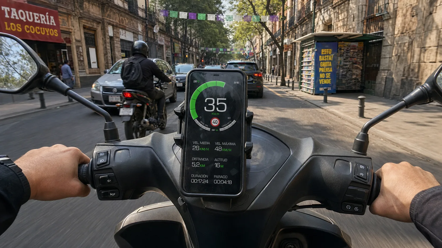
3. GPS Speedometer MPH Tracker (ours) — camera alerts and GPS speed
 GPS Speedometer MPH Tracker
Our app · ★ 4.7 on the U.S. App Store · Cameras + speedometer
We make this app. The details below describe our free and PRO features; they are not an independent ranking or a road test.
Over 139,000 ratings worldwide
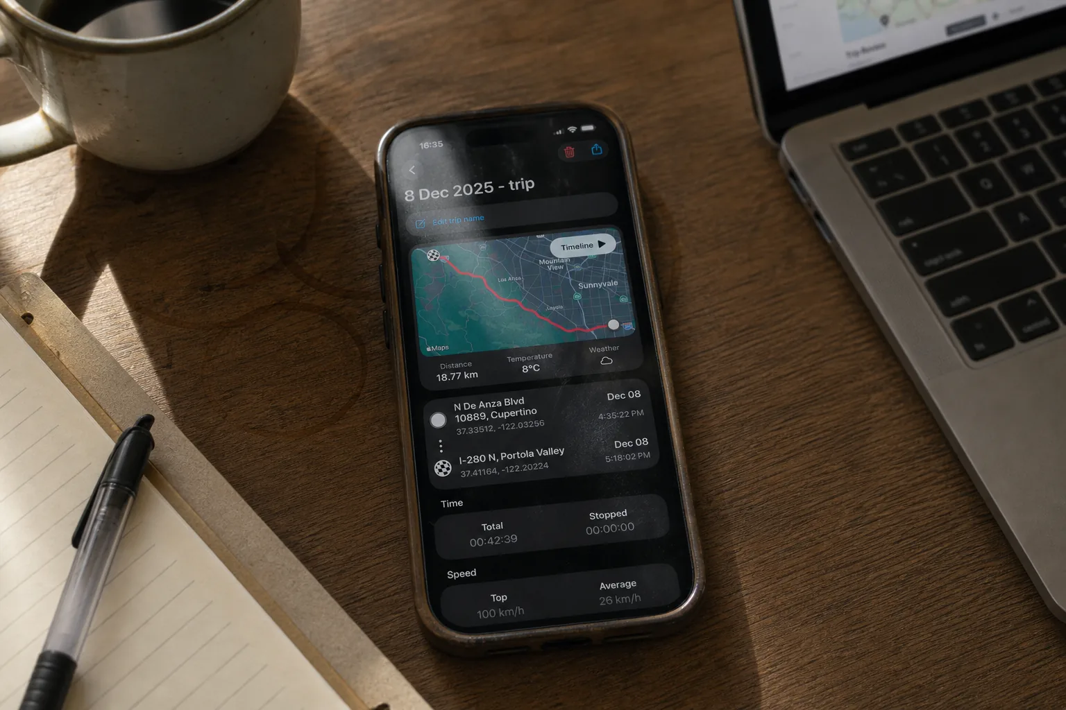
Recording, saving and basic viewing of trips are free. Detailed route playback and analysis require PRO.
PRO unlocks route playback, speed and altitude charts, and detailed trip analysis. Trips saved while PRO stay unlocked if PRO later expires.
Free to download, with no ads. PRO is available through a subscription or a one-time purchase; both unlock the same PRO features. The price depends on your region and current offer; check Apple’s purchase screen.
Core GPS speed tracking and trip recording work without internet, with location permission and a usable GPS signal. Automatic road-speed-limit data and weather need internet. Maps and other connected features may be unavailable offline.
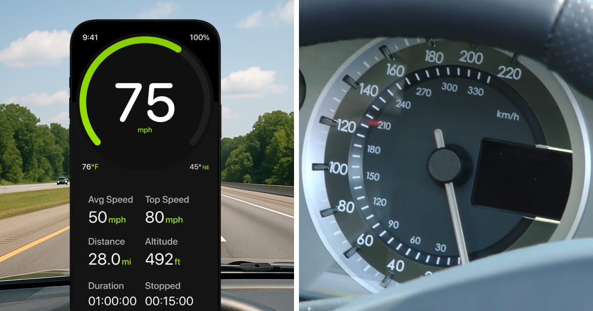
GPS provides an estimate of speed over ground, independent of wheel size. Signal quality, obstructions, low speed and processing can affect the reading. A fixed percentage error or greater accuracy than another instrument is not guaranteed.
GPS can continue in the background while recording a trip or using Picture-in-Picture. Picture-in-Picture requires PRO.
PRO camera alerts use a local camera database and GPS and can work without internet where data is available. Coverage varies by country; database updates need a connection. This does not provide offline road-speed-limit data.
Direction filtering helps reduce irrelevant camera alerts; it does not guarantee zero false or missed alerts. Coverage and local rules vary.
4. TomTom – Maps & Traffic — camera warnings inside navigation
TomTom – Maps & Traffic (4.6★, ~2K ratings in the July snapshot) is a navigation option whose source material describes camera warnings using TomTom data and community input. This is a reason to inspect its warning options if you already use its routing, not a promise about today’s free features.
Before choosing: verify current camera-warning availability, regional coverage and any payment requirements. Consider whether you want a navigation app as well as alerts; this guide does not measure its warning effectiveness.
Task fit: existing TomTom users who want to check the camera options offered with their navigation.
5. Sygic GPS Navigation — offline maps with camera alerts
Sygic (4.55★, ~57K ratings in the July snapshot) is a navigation option associated with downloadable maps and camera and speed-limit features. Offline maps and offline camera warnings are separate capabilities: verify the exact feature and region you need.
Before choosing: check which navigation and camera features are included in the current offer and which require a purchase. A downloaded map does not, by itself, prove that every camera warning works offline.
Task fit: travelers considering downloadable navigation maps who also want to inspect the camera-warning options.
Using camera alerts with a speed estimate
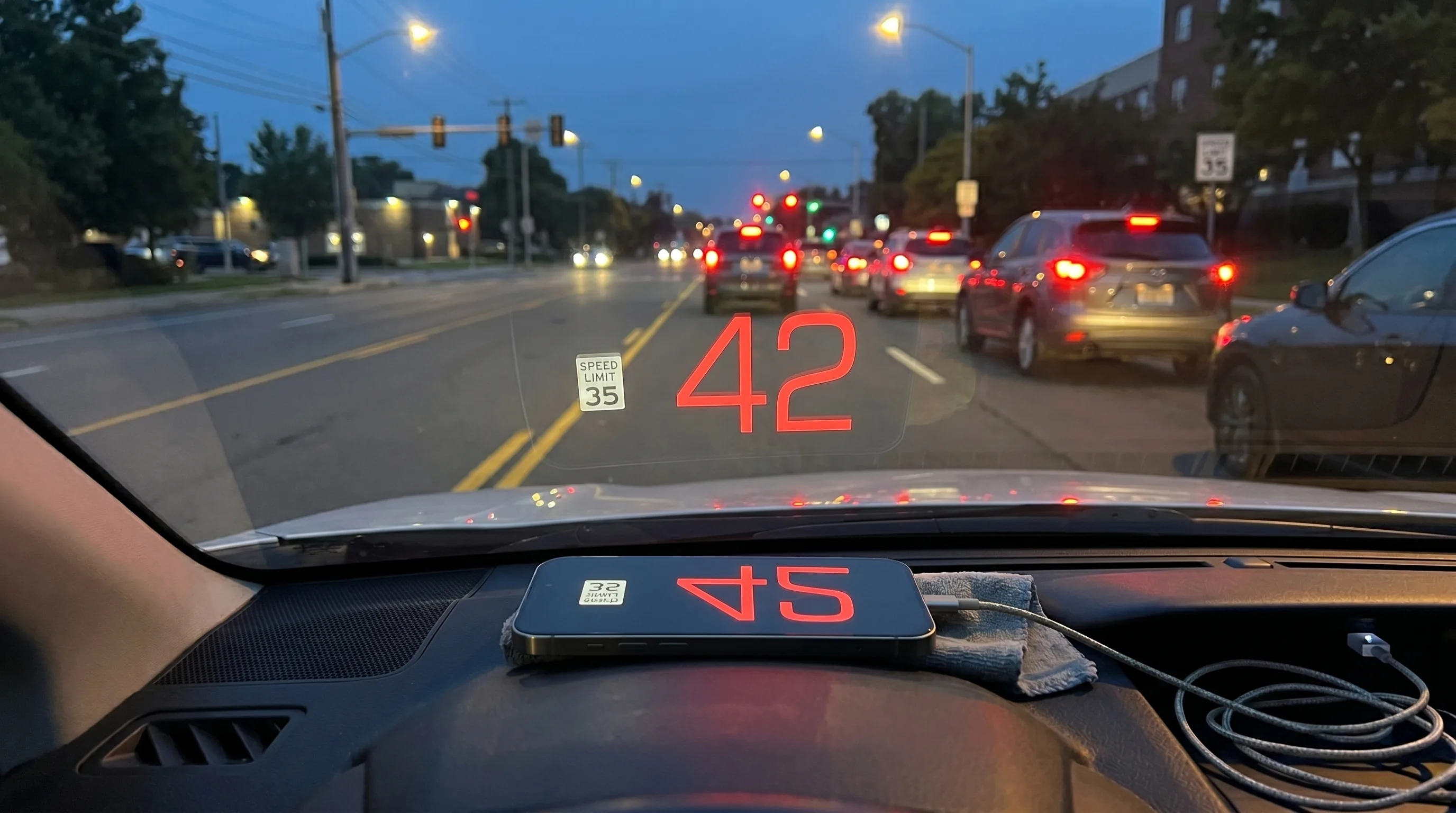
GPS provides an estimate of speed over ground, independent of wheel size. Signal quality, obstructions, low speed and processing can affect the reading. A fixed percentage error or greater accuracy than another instrument is not guaranteed.
Road-limit display and manual controls require PRO. Automatic road-data lookup requires internet; a manually selected threshold is a separate setting. Automatic road-limit fallback uses road type and location. Displayed limits can be incomplete or inaccurate; follow posted signs. Offline road-limit packs are not available. A temporary in-memory value is not an offline road database.
Direction filtering helps reduce irrelevant camera alerts; it does not guarantee zero false or missed alerts. Coverage and local rules vary.
Frequently Asked Questions
What is the best speed camera detector app for iPhone in 2026?
There is no tested winner in this guide. Consider Radarbot for a dedicated camera-alert app, Waze for navigation with community reports, and GPS Speedometer MPH Tracker for speed and trip tools with PRO camera alerts. Our SCDB.info data covers 40+ supported countries, subject to available records and regional behavior. Check the current offer and local rules for your destination.
Free to download, with no ads. PRO is available through a subscription or a one-time purchase; both unlock the same PRO features. The price depends on your region and current offer; check Apple’s purchase screen.
Can an iPhone actually detect police radar?
No. The iPhone on its own does not have a K/Ka/X-band radar receiver. Radar detection requires suitable radio hardware; lidar detection uses dedicated optical equipment. The GPS warning apps discussed here use known locations or reports, not direct detection of those signals.
Do speed camera apps detect mobile or hidden cameras?
A database can contain known or historical enforcement sites, while a report can describe a more recent situation. Neither proves that a mobile or hidden camera is present now. Coverage depends on the app, available records and reports, and the region; no complete coverage is established here.
Are speed camera detector apps legal?
Rules depend on the country, the function and how it is used. A GPS-based app is not automatically permitted: Germany’s driver restriction also covers knowingly benefiting from a passenger’s active camera-warning app; France and Switzerland have their own restrictions. Check current official guidance before use. See our overview of speed-camera laws by country.
Do speed camera apps work offline?
Some apps can match GPS positions against camera data already stored on the phone without a data connection. That does not mean every feature or region works offline. Live reports need a connection, and provider updates are separate from the data currently stored on your device. Check the specific app’s current offline conditions.
GPS Speedometer MPH Tracker: PRO camera alerts use a local camera database and GPS and can work without internet where data is available. Coverage varies by country; database updates need a connection. This does not provide offline road-speed-limit data.
Do I still need a speedometer if I have a camera app?
GPS Speedometer MPH Tracker: GPS provides an estimate of speed over ground, independent of wheel size. Signal quality, obstructions, low speed and processing can affect the reading. A fixed percentage error or greater accuracy than another instrument is not guaranteed. Road-limit display and manual controls require PRO. Automatic road-data lookup requires internet; a manually selected threshold is a separate setting. Automatic road-limit fallback uses road type and location. Displayed limits can be incomplete or inaccurate; follow posted signs. Offline road-limit packs are not available. A temporary in-memory value is not an offline road database. Direction filtering helps reduce irrelevant camera alerts; it does not guarantee zero false or missed alerts. Coverage and local rules vary.
Sources & further reading
- Radarbot on the App Store — current listing for a dedicated camera-alert option.
- Waze Navigation & Live Traffic — navigation and community reports.
- GPS Speedometer MPH Tracker on the App Store — our speedometer and PRO camera alerts.
- Speed cameras: how they work and our coverage — the SCDB.info data behind our alerts.
- Speed-camera laws by country — regional rules and evidence limitations.
The bottom line
Choose the task first: inspect Radarbot for dedicated camera warnings, Waze for navigation with reports, or GPS Speedometer MPH Tracker if you want our GPS speedometer and trip tools with optional PRO camera alerts. Then check destination coverage, paid-feature conditions and applicable rules. A location warning is information to use responsibly, not a radar receiver or permission to exceed the limit.
Direction filtering helps reduce irrelevant camera alerts; it does not guarantee zero false or missed alerts. Coverage and local rules vary. GPS provides an estimate of speed over ground, independent of wheel size. Signal quality, obstructions, low speed and processing can affect the reading. A fixed percentage error or greater accuracy than another instrument is not guaranteed.