Boat GPS Speedometer with Knots Display
Track boat speed in knots with GPS. Perfect for boating, sailing, kayaking, jet skis, and all watercraft. Also works great for RVs and other large vehicles. Record trips, distance, and routes.
Perfect For All Watercraft
From sailing yachts to jet skis, the same app reads true GPS speed for every kind of watercraft you'll set foot on.
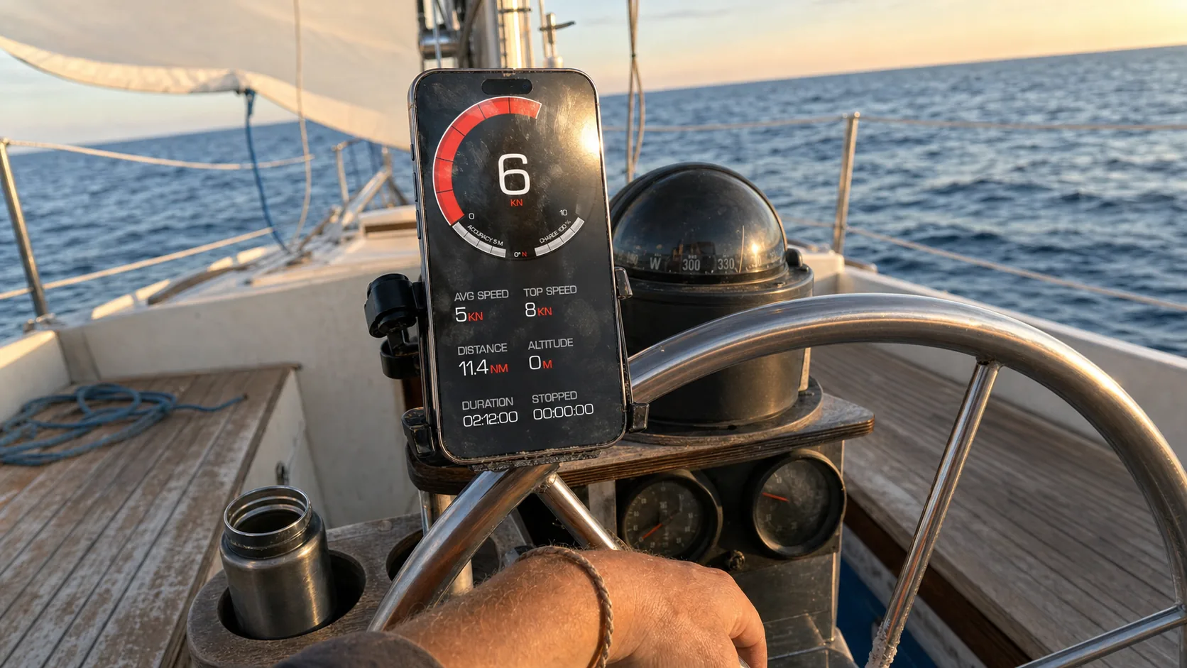
Sailing & Sailboats
- Track speed through water in knots
- Monitor sailing performance and VMG
- Record distances on cruising trips
- Backup for marine speedometer/knotmeter
- Works when boat speed sensor fails
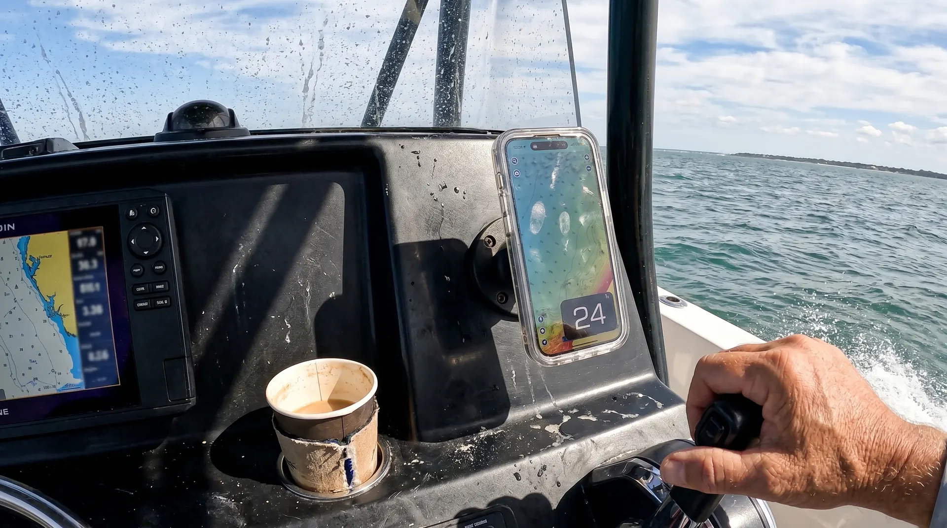
Powerboats & Motorboats
- Accurate speed for boats without speedometers
- Replace broken marine speedometers
- Verify boat performance and top speed
- Track fuel economy with distance data
- Monitor plane-off speeds and cruising
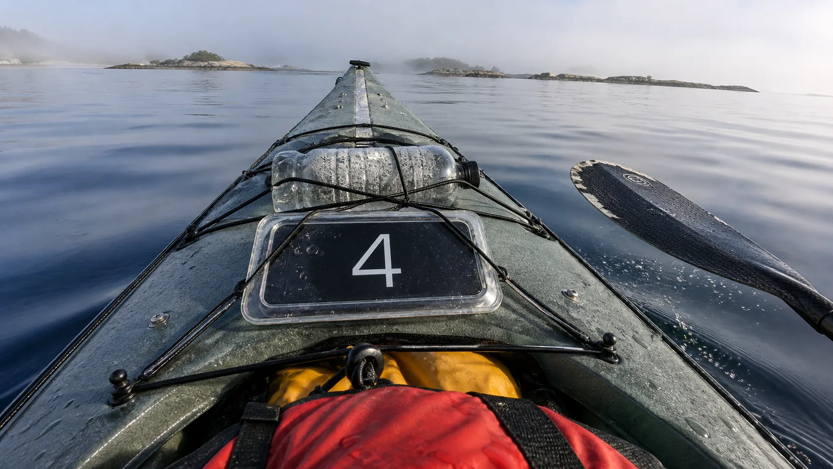
Kayaking & Canoeing
- Track paddling speed and distance
- Monitor kayak touring trips
- Record routes for future reference
- Track training progress over time
- Measure average paddling speeds
Water Sports & PWC
- Jet ski and personal watercraft speed
- Wakeboarding and water skiing tracking
- Track kitesurfing and windsurfing speeds
- Monitor SUP (stand-up paddleboard) distance
- Record maximum speeds for bragging rights
Large Vessels & Yachts
- Backup navigation instrument
- Verify primary speedometer accuracy
- Track cruising distances
- Monitor passage times and speeds
- Record boat delivery trips
Fishing & Trolling
- Maintain precise trolling speeds
- Track fishing spot distances
- Record productive fishing routes
- Monitor drift speeds
- Document fishing trip distances
Why Boaters Choose GPS Speedometer
The reasons boaters reach for GPS Speedometer over a built-in marine speedometer or knotmeter.
Knots Display
Speed displayed in knots (nautical miles per hour) - the standard marine speed unit. Also supports MPH and KPH for inland boating. Switch units instantly.
1-2% GPS Accuracy
GPS provides 1-2% accuracy for true speed over ground. Read more about GPS tracking technology. More accurate than many marine speedometers which can be affected by fouling, calibration, or paddle wheel issues.
No Installation Costs
Marine speedometer installation costs $200-$800+. GPS Speedometer is free to download with no installation, no transducers, no through-hull fittings required.
Portable Between Boats
Use the same app on your sailboat, powerboat, kayak, or any watercraft. No need for separate instruments on each vessel. Just bring your iPhone.
Trip Recording & History
Record complete marine trips with route, distance, duration, and speeds. Save favorite routes. Review past voyages. Export GPX files for chart plotters.
Works in Open Water
GPS works anywhere with satellite visibility - coastal waters, open ocean, lakes, rivers. No cell service needed for basic speed and distance tracking.
Marine-Specific Features
Built for the things that actually matter on the water.
Speed in Knots (Nautical Miles)
Display speed in knots - the standard marine speed unit. 1 knot = 1.15 MPH = 1.85 KPH. Easy switching between knots, MPH, and KPH for different waters.
Distance Tracking
Track nautical miles traveled. Monitor distances for passage planning, fuel consumption estimates, and trip documentation.
Average Speed & Time
Calculate average speed for accurate ETA predictions. Monitor trip duration. Essential for passage planning and fuel calculations.
Route History
Record and save boat routes. Review past trips and favorite anchorages. Export routes as GPX files compatible with marine chartplotters and navigation software.
Max Speed Recording
Track maximum boat speed achieved. Monitor boat performance. Compare speeds in different conditions or after bottom cleaning/prop changes.
Weather Information
View current weather conditions and forecasts at your location (when internet available). Helpful for planning on-water activities.
How to Use on Your Boat
Download GPS Speedometer
Free download from App Store. Grant location access for GPS tracking. Select knots as your speed unit in settings.
Mount iPhone on Boat
Use waterproof case and marine-grade phone mount. Position with clear sky view for best GPS reception. Secure against waves and boat movement.
Wait for GPS Signal
Allow 1-2 minutes for initial GPS satellite lock. Clear sky view improves accuracy. Works best in open areas without obstructions.
Start Your Trip
Speed displays in real-time as you move. Optional: Start trip recording to save route, distance, and statistics for documentation.
Marine Mounting & Usage Tips
Waterproof Protection Essential
Use waterproof phone case (Lifeproof, Otterbox, or similar). Protect from spray, rain, and splash. Consider dry bag or waterproof pouch for extreme conditions. Test waterproofing before taking on water.
Secure Mounting
Use marine-grade mounts designed for boats. RAM Mount, Scanstrut, or similar marine products. Secure against waves, boat movement, and wind. Test mount security before heading out.
Power for Long Trips
GPS uses battery. For extended trips, use marine USB charger or 12V adapter. Many boats have USB charging ports. Keep iPhone charged for all-day tracking.
Screen Visibility in Sun
Maximum brightness for visibility in bright sunlight. Anti-glare screen protectors help. Position mount to minimize direct sun glare. Consider shade or bimini protection.
Backup Navigation
GPS Speedometer is great for speed and distance, but not a replacement for proper marine navigation. Always have charts, compass, and primary navigation equipment. Use as supplementary instrument.
Frequently Asked Questions
Ready to Track Boat Speed in Knots?
Download GPS Speedometer and start tracking your marine adventures today.
Perfect for sailing, powerboats, kayaking, jet skis, and all watercraft
Marine Navigation Disclaimer: GPS Speedometer is a supplementary instrument for speed and distance tracking. Not a replacement for proper marine navigation equipment, charts, or nautical instruments required for safe boating.